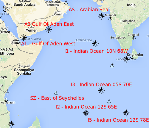
There are several Routing Points you can utilize to route you vessel to retrieve the most accurate distance based on current routing advice in high risk areas.
These are not considered automatically and must be added manually.
Step-by-step guide
- Locate the Routing Point you want by looking at the map.
- Hover over with your cursor (or click) the routing point symbol
 to see the name and Routing Point Code for the routing point.
 - Enter the name (or routing point code) of the routing point in the "Search" field
- When routing point is on the top of you search results hit the "Tab" key to fulfill the name (or write it out), and hit "Enter" key (or the "Add" button)
- If applicable drag the newly added Routing Point to the correct place in the list of ports/routing points.
- Ensure that your route is updated according by verifying the sailing route.
Map | Description / Name | RP Code | Latitude | Longitude |
|---|---|---|---|---|
| Gulf Of Aden West Bound | A1 | 11°59'N | 45°00'E |
Examples
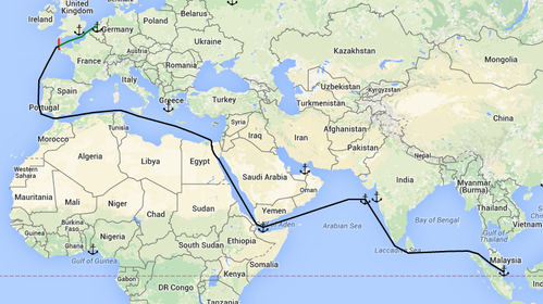
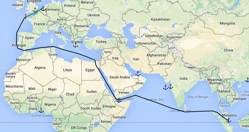
| Rotterdam - AS - Singapore (with routing point) | Rotterdam - Singapore (without routing point) |
 |  |
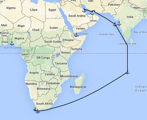
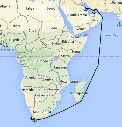
| Ras Tanura - I5 - Cape Town (with routing point) | Ras Tanura - Cape Town (without routing point) |
 |  |
Related articles